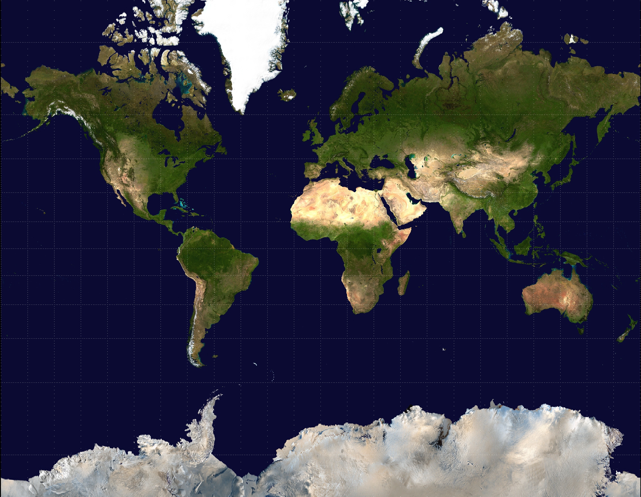
Actually I learned about this in high school. Mercator's projection makes the northern areas look much bigger, and the southern areas smaller. I remember my teacher saying it was made that way to make Europe look more impressive and majestic, while making Africa and South America look smaller and weaker. I'm pretty sure he was full of shit, but it would make sense, Europe was colonizing the shit out of everyone at the time Mercator came up with his projection (15XX)
Valdronius
Moderator
Title: SydLexia COO
Joined: Aug 22 2005
Location: The Great White North
Posts: 4467
Posted:
Apr 10 2011 07:47 pm
I heard it was because they made maps by wrapping a piece of paper around the equator of a globe, and the projection from the globe made the land nearer the poles stretched and skewed.
Klimbatize wrote:
A Hispanic dude living in Arizona knows a lot of Latinas? That's fucking odd.
Blackout
Title: Captain Oblivious
Joined: Sep 01 2007
Location: That Rainy State
Posts: 10376
Posted:
Apr 10 2011 08:07 pm
Let's skin the crust off the earth with some sort of unimaginably large machine and spread it out on a God's coffee table to make damn sure we get an accurate measurement!
Drew Linky
Wizard
Joined: Jun 12 2009
Posts: 4209
Posted:
Apr 10 2011 09:50 pm
Meh.
https://discord.gg/homestuck is where you can find me literally 99% of the time. Stop on by if you feel like it, we're a nice crowd.
Mr. Satire
Joined: Jun 08 2010
Location: Termina Field
Posts: 1541
Posted:
Apr 10 2011 09:52 pm
Sehkmaenzo wrote:
Actually I learned about this in high school.
This.
Also, I like how my country is taller on the Gall-Peters map.
Signature by Hacker (RIP)
SNESGuy
Title: El Duderino
Joined: Jul 31 2010
Location: Da D.C
Posts: 1831
Posted:
Apr 10 2011 10:12 pm
Drew Linky wrote:
Meh.
Double Meh
Sehkmaenzo
Joined: Jun 29 2010
Posts: 1818
Posted:
Apr 11 2011 06:11 am
Mr. Satire wrote:
Sehkmaenzo wrote:
Actually I learned about this in high school.
This.
Hmmm... So, they only tell us southies? Maybe my teacher was on to something
Alowishus
Joined: Aug 04 2009
Posts: 2515
Posted:
Apr 11 2011 08:20 am
I knew this, probably cause i'm doing a degree in geography :p
Black Zarak
Title: Big Coffin Hunter
Joined: Feb 01 2006
Location: Phyrexia
Posts: 4098
Posted:
Apr 11 2011 10:14 am
They probably taught me this in school, I just don't remember. Probably because it really doesn't matter that much.
"Let that be a lesson to you, your family and everyone you've ever known..."
"Thanks to denial, I'm immortal!"
Alowishus
Joined: Aug 04 2009
Posts: 2515
Posted:
Apr 11 2011 10:41 am
Black Zarak wrote:
Probably because it really doesn't matter that much.
You just didn't go there!
Slayer1
Title: ,,!,, for you know who
Joined: Sep 23 2008
Posts: 4274
Posted:
Apr 11 2011 10:43 am
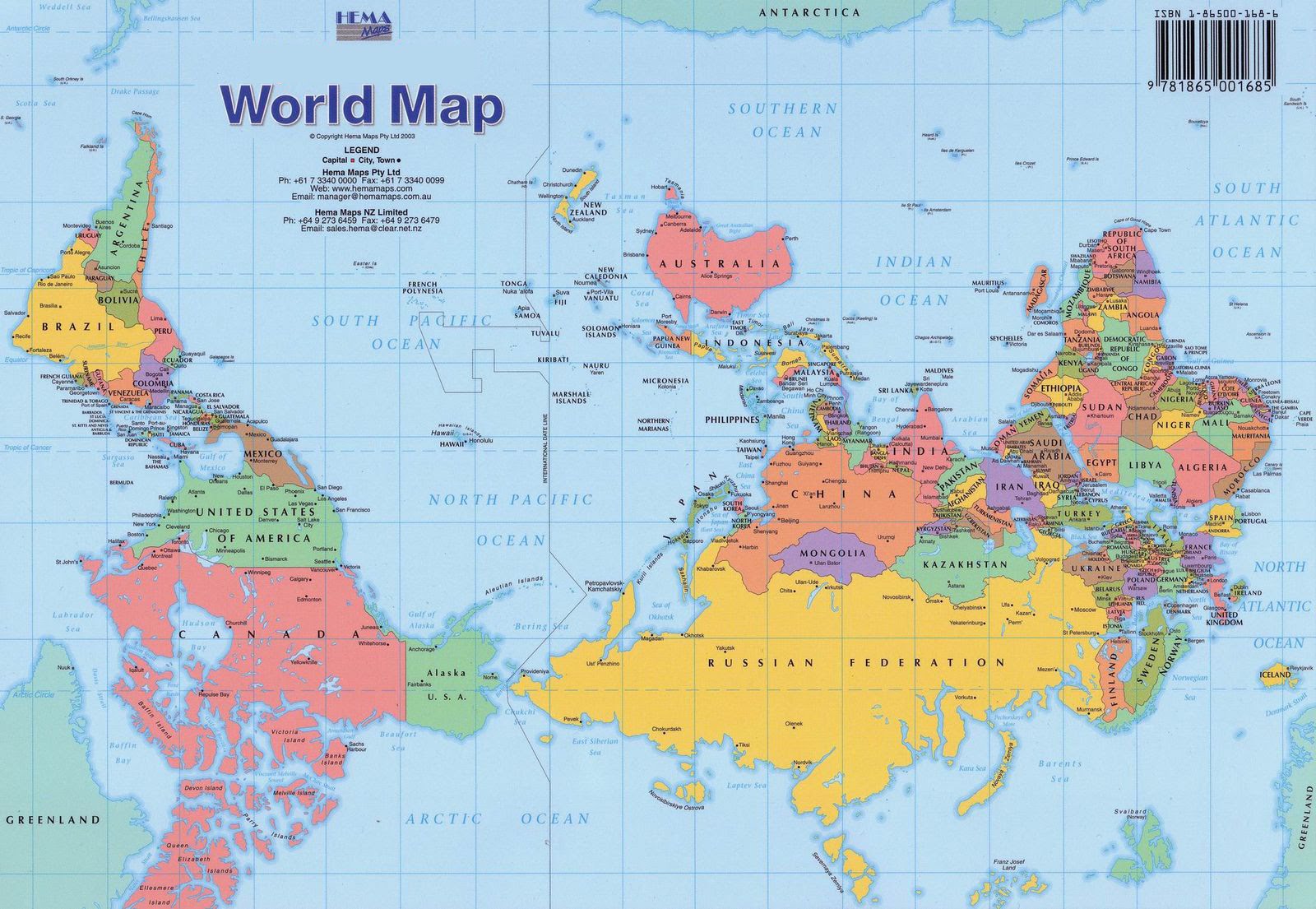
Every time I see this thread, I think it says "The Mop is a lie" and I get in the hopes of an awesome mop fight amongst ninja masters... damn
I like this map better actually
brellow
Joined: Mar 08 2011
Location: Ohio
Posts: 131
Posted:
Apr 11 2011 10:45 am
Hi guys! Turns out you can't make a rectangular map of the earth by cutting the skin off and spreading it around. To force the surface of the earth into a rectangular shape you have to make a sacrifice. You may either preserve the distance between points (aka preserve a countries size) or you may preserve the angles between two points. Back when Mercator was living the primary use for a world map was by international travel...across the ocean. So he came up with his projection that preserved angles between points so that people could use it to plot courses accurately.
Where did I learn this? Mathematics, you can prove that you must sacrifice angles or distance with some topology or some inventive calculus. Of course people alive now don't ever learn that and when they discover that most of the continents are much bigger than they thought, they start talking about having been lied to.